AUTOMATION PRIORITIZATION
Identifying automation opportunities across the operational workflow
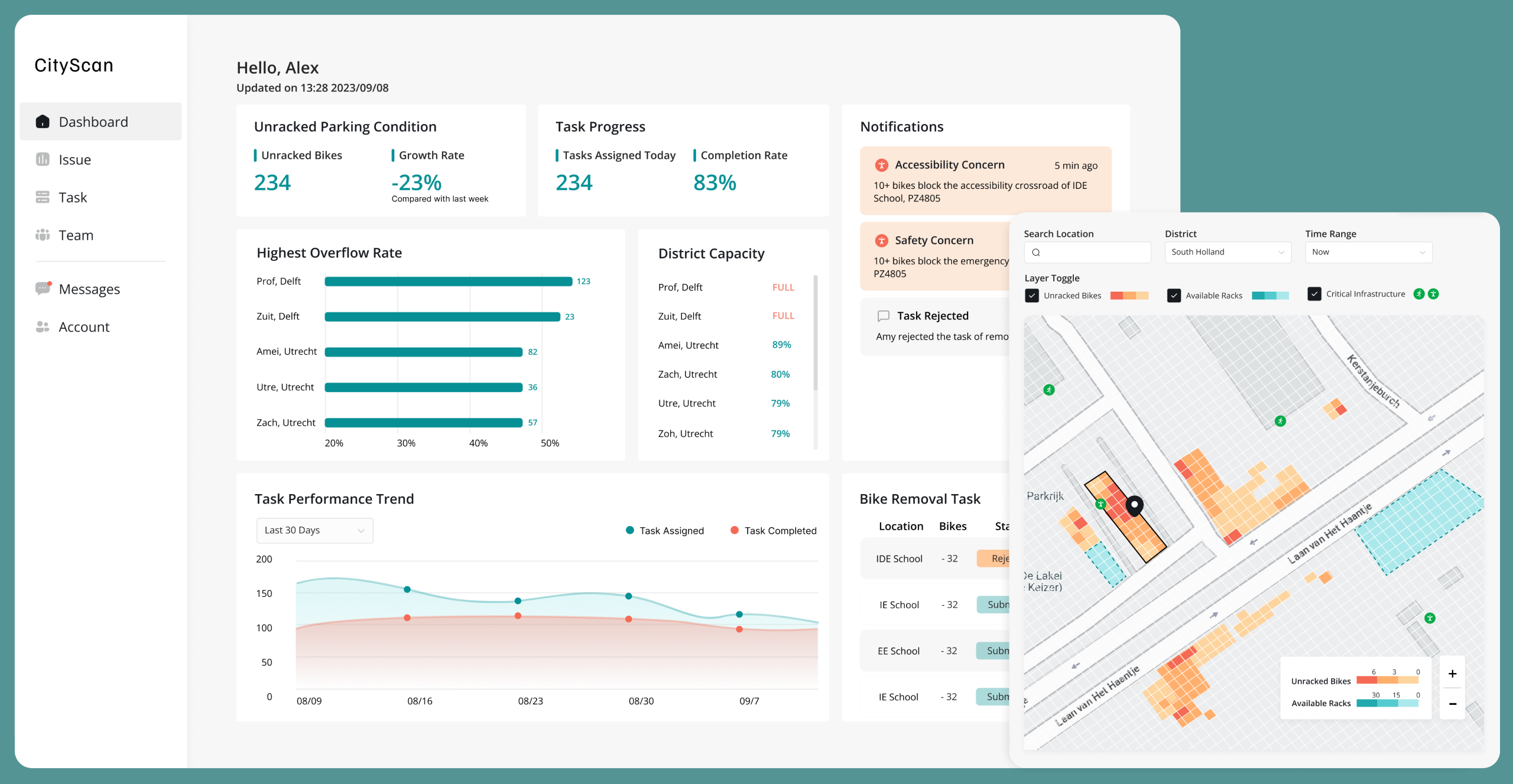
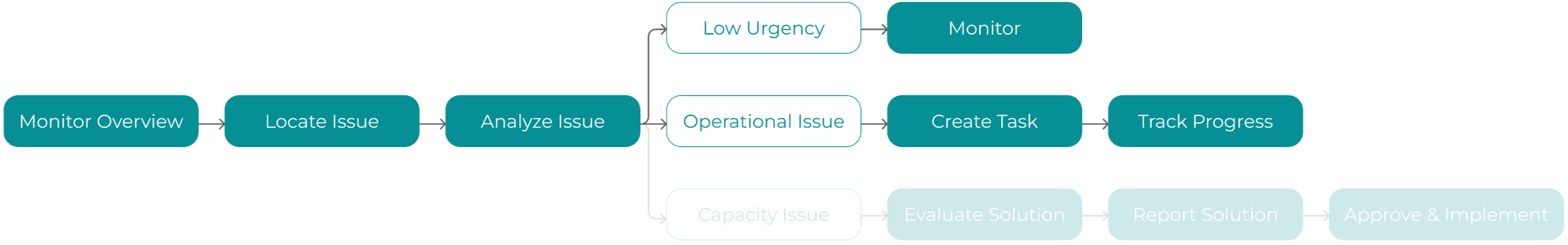
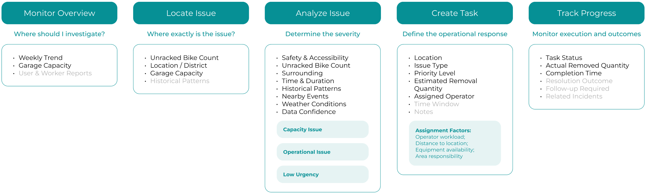
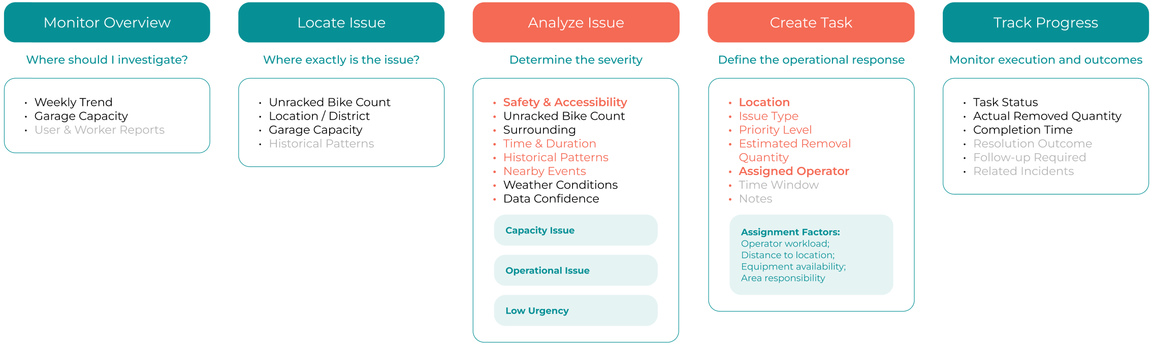
Since issue analysis and task creation require evaluating multiple metrics, they present strong opportunities for automation. To maintain user trust and control, we didn't automate the whole process. Automation was prioritized for safety, accessibility, and operator assignment processes.
Prioritization Logic
"Low-effort changes but make our client see the potential and get excited."
1. High impact, low risk decisions
2. Repetitive information processing
3. Low effort and good effect for our product
AUTOMATION 01
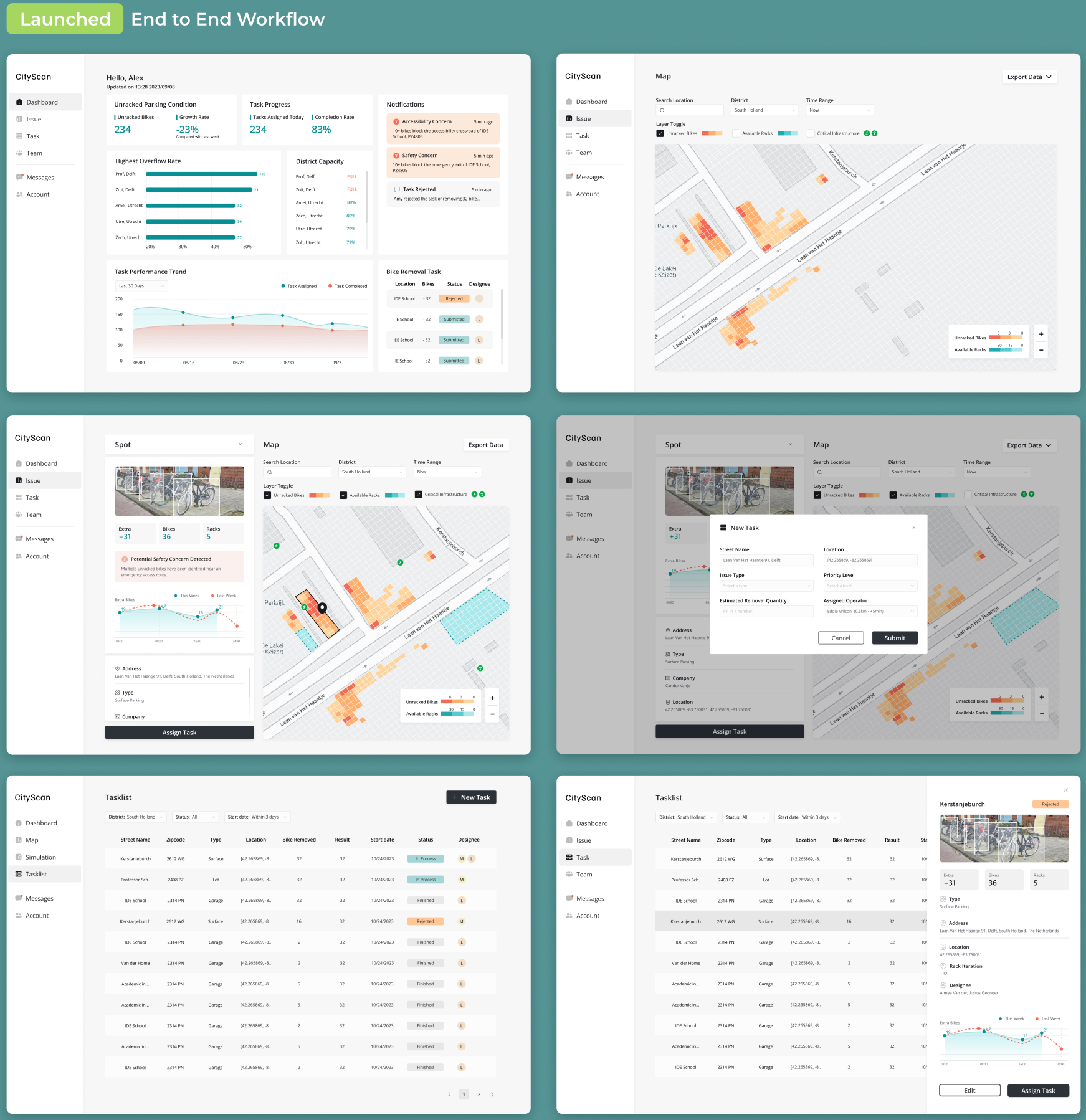
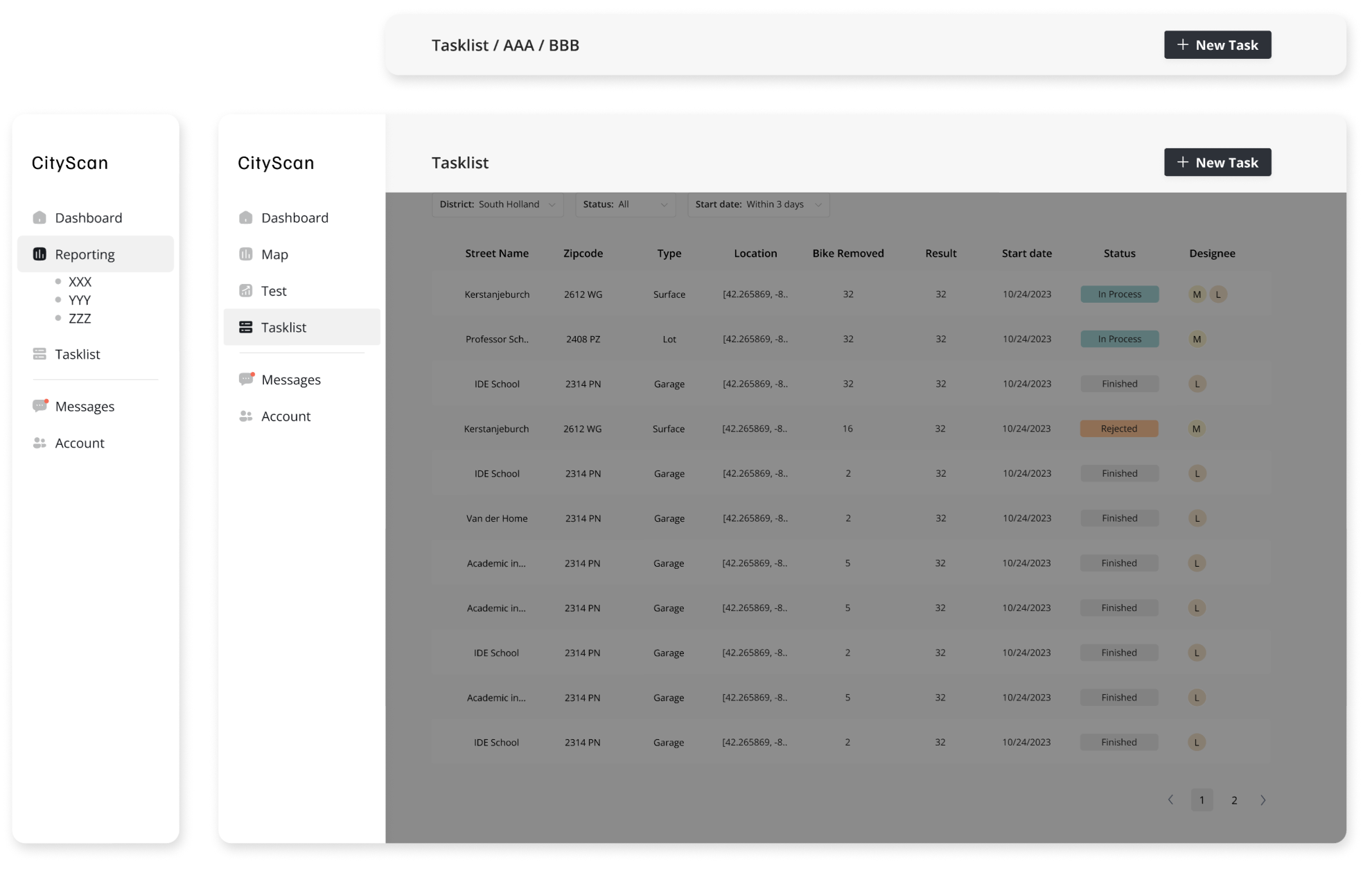
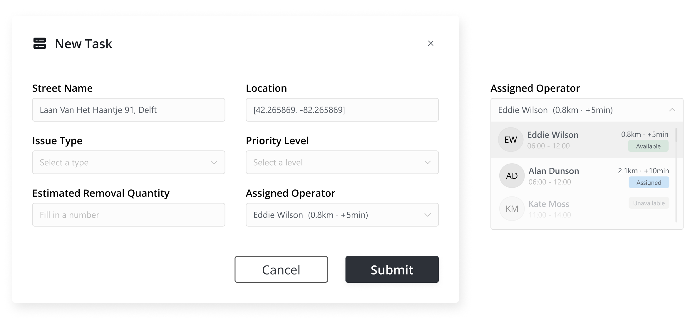
Recommend the best operator for task assignment
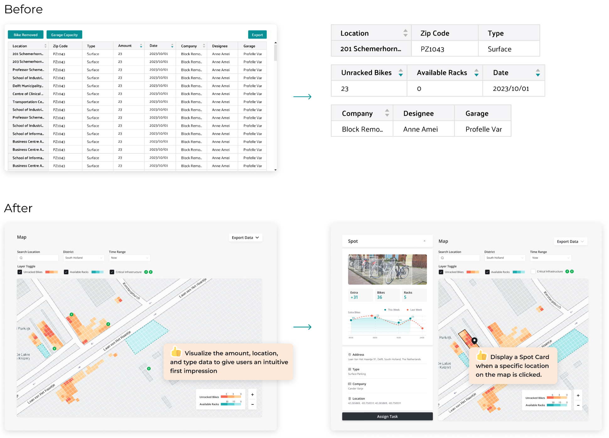
Automatically suggest the most suitable operator based on location proximity, workload, availability, and area responsibility.
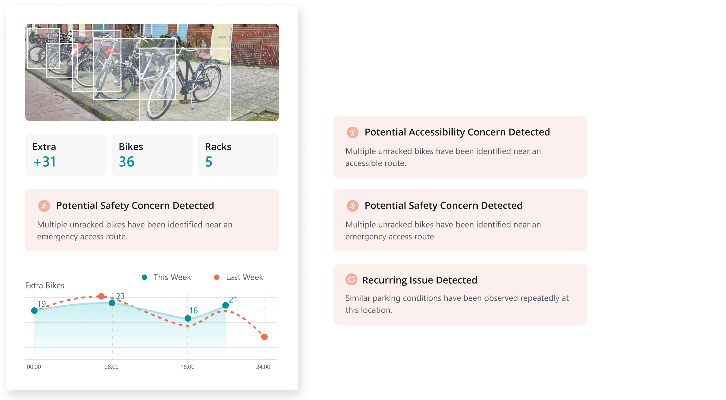
AUTOMATION 02
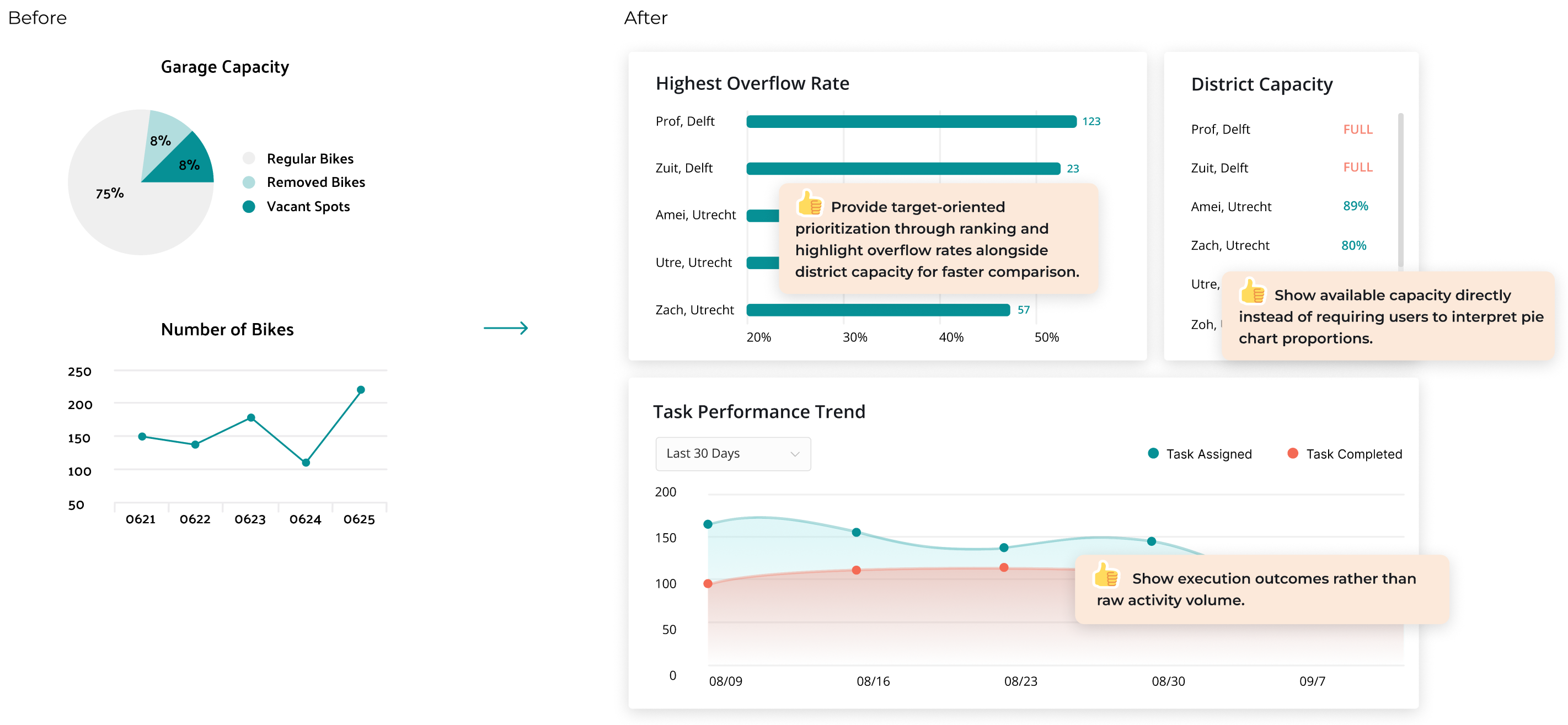
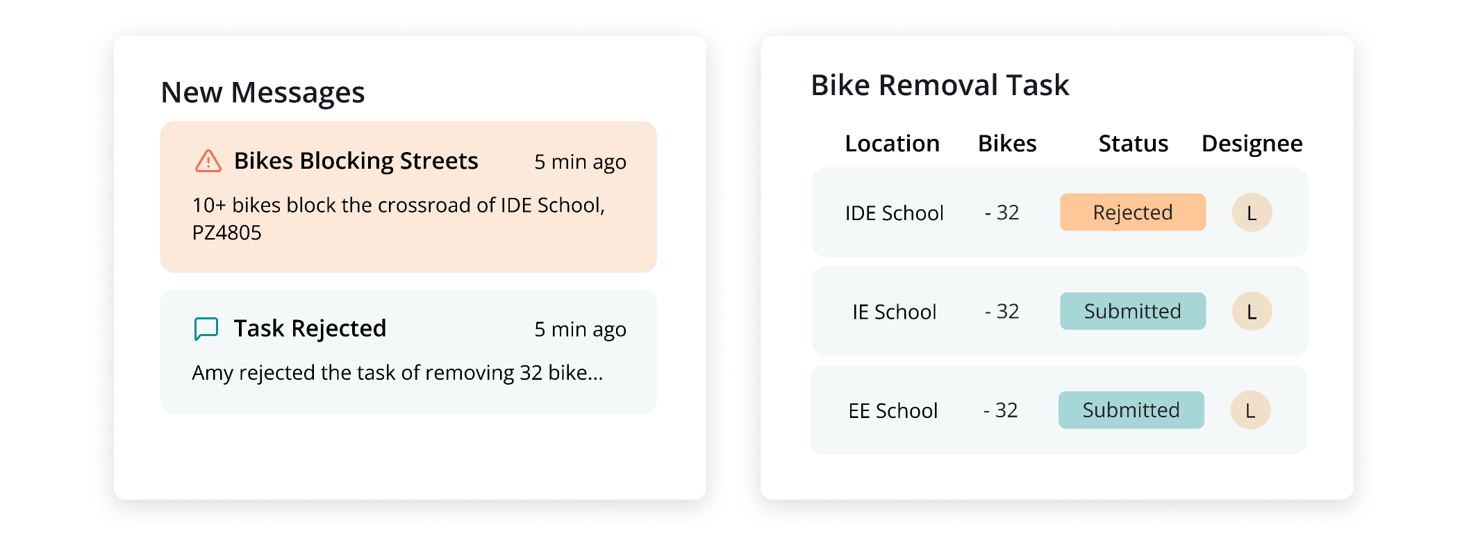
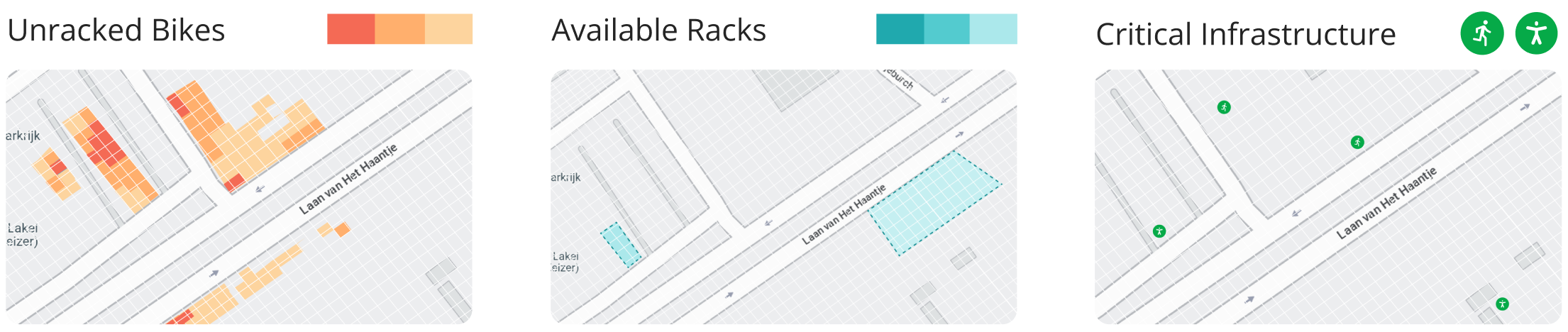
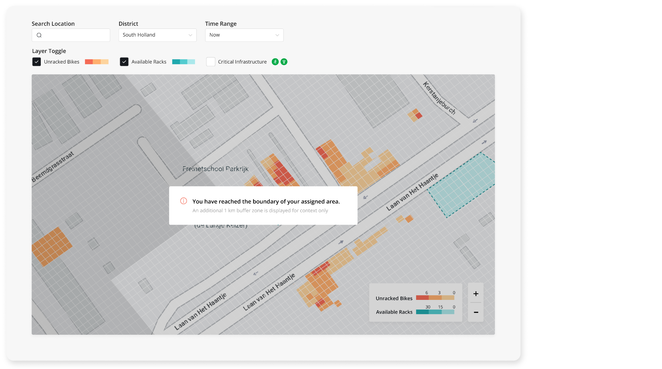
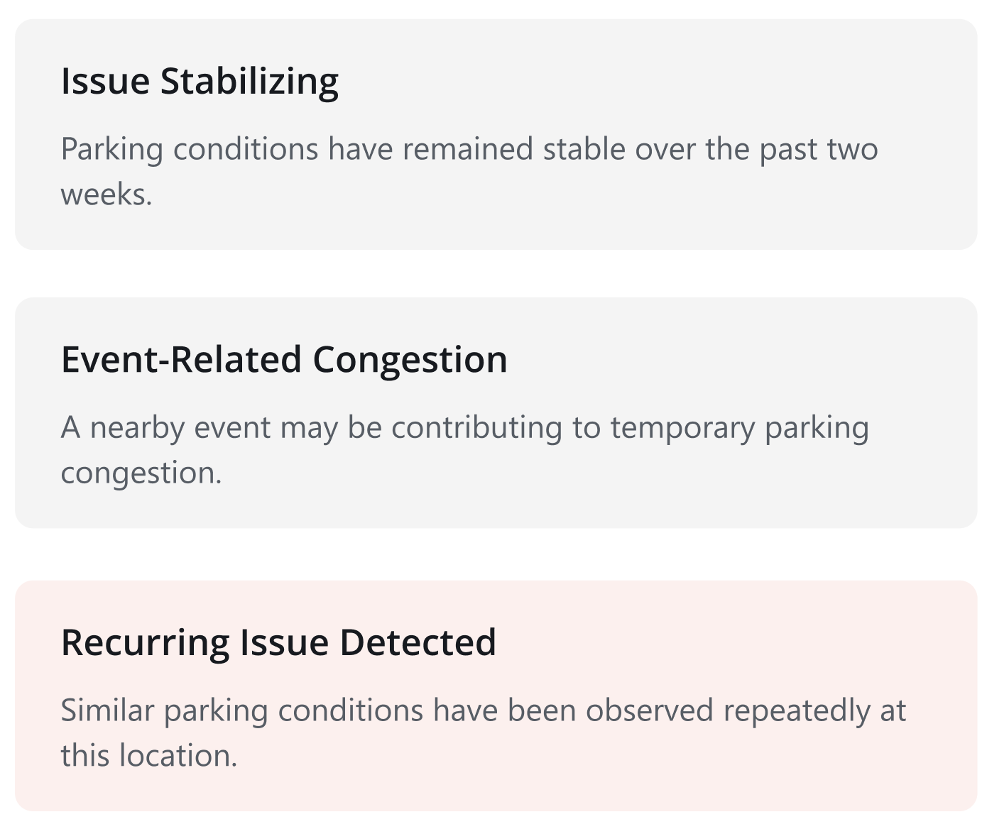
Automatically detect operational risks and patterns
Analyze parking conditions, safety risks, accessibility concerns, and historical trends to support faster operational decisions.